Current indications are that much of the frozen precipitation in southern Ontario will be in the form of sleet and ice pellets with perhaps some snow mixed in. In Ottawa, it looks to be the opposite, mostly snow with some ice pellets and sleet.
Here are some snow accumulation maps from various models for the next 84 hrs.
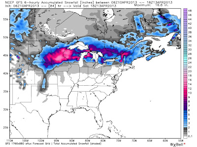 |
| GFS |
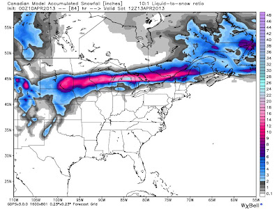 |
| Env Can. |
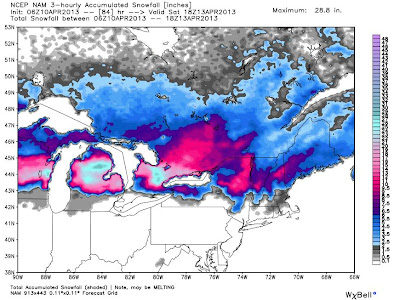 |
| NAM |
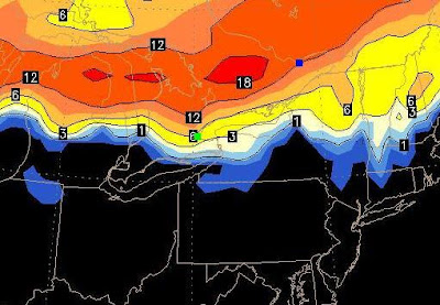 |
| Euro |


No comments:
Post a Comment