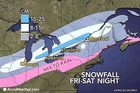
I am sceptical of these amounts. Rather I think the maps will be updated later showing the band of snow shifting south, meaning we will be on the north side of the heaviest band. The latest NAM has trend the storm south and stringing it out. Currently I am thinking we'll get 5-10cms Saturday.
As for the storm next Wednesday, the models are trending towards a solution that has an initial system heading up towards the lower Great Lakes from the SW and a secondary low developing off the coast sucking the energy from the first. If correct, we'll again miss the heart of the snow as it will primarily be in the US NE.
Oh, and there's a similar type storm showing up on the models for next weekend as well.
Stay tuned.
No comments:
Post a Comment